Clackamas Falls
Details
- GPS: 45.188409, -122.22911
- Elevation: 953 feet
- Attraction Type: Waterfall
- Waterfall height: 191 feet
- Waterfall Source: South Fork Clackamas River
Clackamas Falls Attraction Description
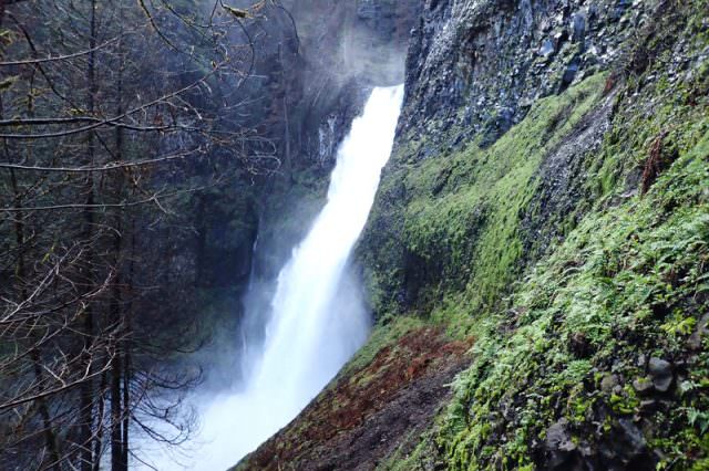
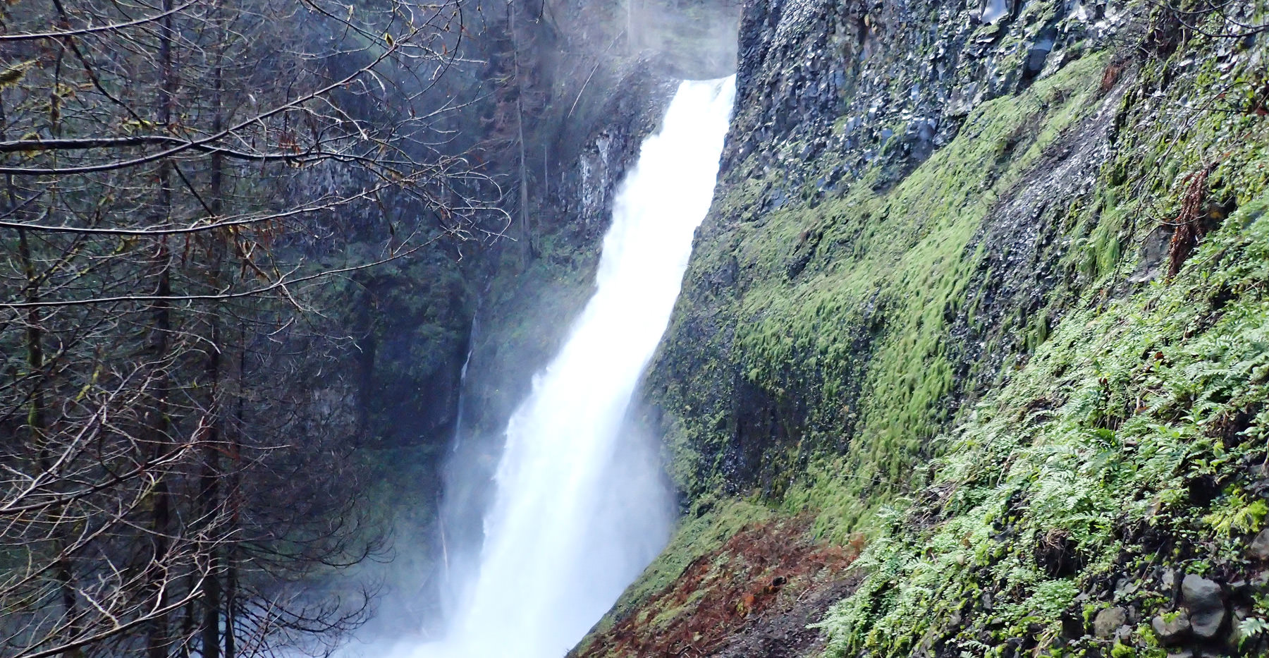
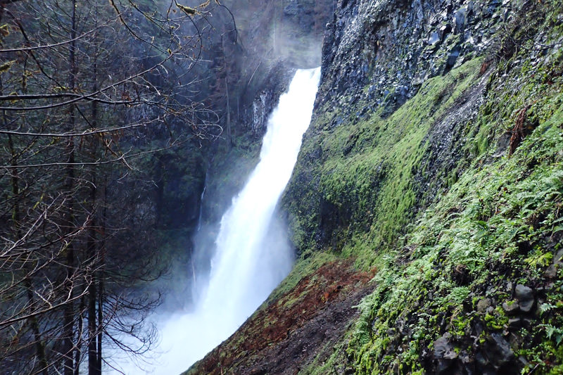
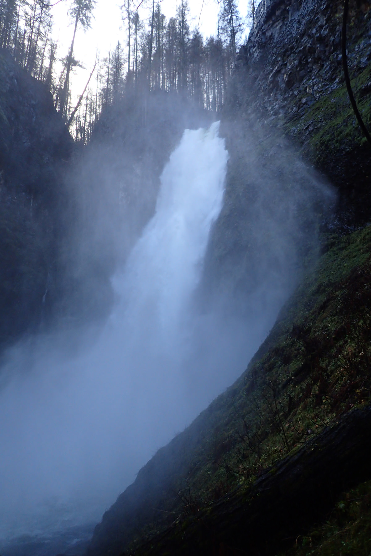
Clackamas Falls is a massive and impressive waterfall that seldom sees visitors and is fairly difficult to get to due to the lack of a developed trail. Located on the South Fork Clackamas Creek the waterfall plummets a massive 191 feet.
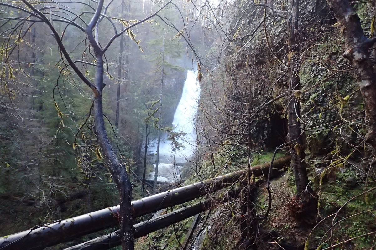
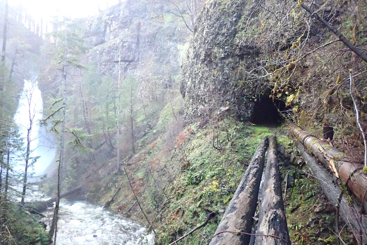
Clackamas Falls is a unique waterfall in that access to it requires descending a steep cliff, hiking through manmade tunnels and crossing several crumbling bridges. There is no real trail to access the falls and the nearby access road is closed making it a long and difficult hike in.
History of Clackamas Falls
In 1915 the cities of Oregon City and West Linn were faced with a water crisis. A Typhoid breakout occurred in their water and they found themselves without a reliable source of water for the cities. As a result, they decided to look for a more pure source of water and ventured further up the Clackamas River until they discovered the South Fork Clackamas River and Memaloose Creek. Here they constructed a Pipeline to deliver clean water to West Linn and Oregon City. After some time they decided to extend the pipeline even further up the mountain to increase water pressure to residents. This resulted in a massive tunnelling system that runs adjacent to Clackamas Falls and far up the South Fork Clackamas River. They dubbed this new water pipeline as the “Mountain Line”.
Today what remains of the Mountain Line is a deteriorating network of bridges, tunnels and massive pipes. It serves as a peek into life before the luxuries of water treatment facilities and pumping stations. You can learn more about the history of the Mountain Line by visiting the South Fork Water Board website.
Visiting Clackamas Falls and the Memaloose Creek Area
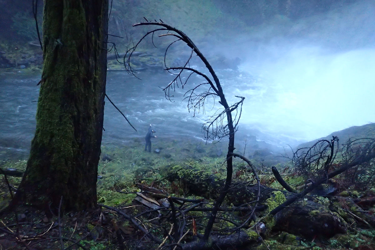
If you are considering checking out Clackamas Falls or any of the other waterfall nearby PLEASE, PLEASE exercise EXTREME caution. If you are not an avid hiker do not attempt this. Getting to the area requires descending steep, dangerous slope, with sketchy barely in-tact ropes. There is no trail and at one point you must jump roughly 6 feet onto a rotting bridge. This is just the start of the hazards on this hike. If you go, go with a buddy, tell someone where are headed and be smart.
Clackamas Falls Map
Videos
Weather for Clackamas Falls
Clackamas Falls Campground Photos
Nearby Campgrounds
|
Lazy Bend 1.1 Miles Away
|
Promontory Park No image for this location. 2.2 Miles Away
|
Carter Bridge 3.8 Miles Away
|
Lockaby 4.1 Miles Away
|
Armstrong 4.1 Miles Away
|


No Title
No Title
No Title
Comments/Questions